


Our Services
-

ORTHOMOSAIC MAPPING
Orthomosaic mapping delivers high-resolution, accurate maps from drone imagery, transforming how you analyze and manage land projects. Get precise, actionable insights for your site in stunning detail.
-

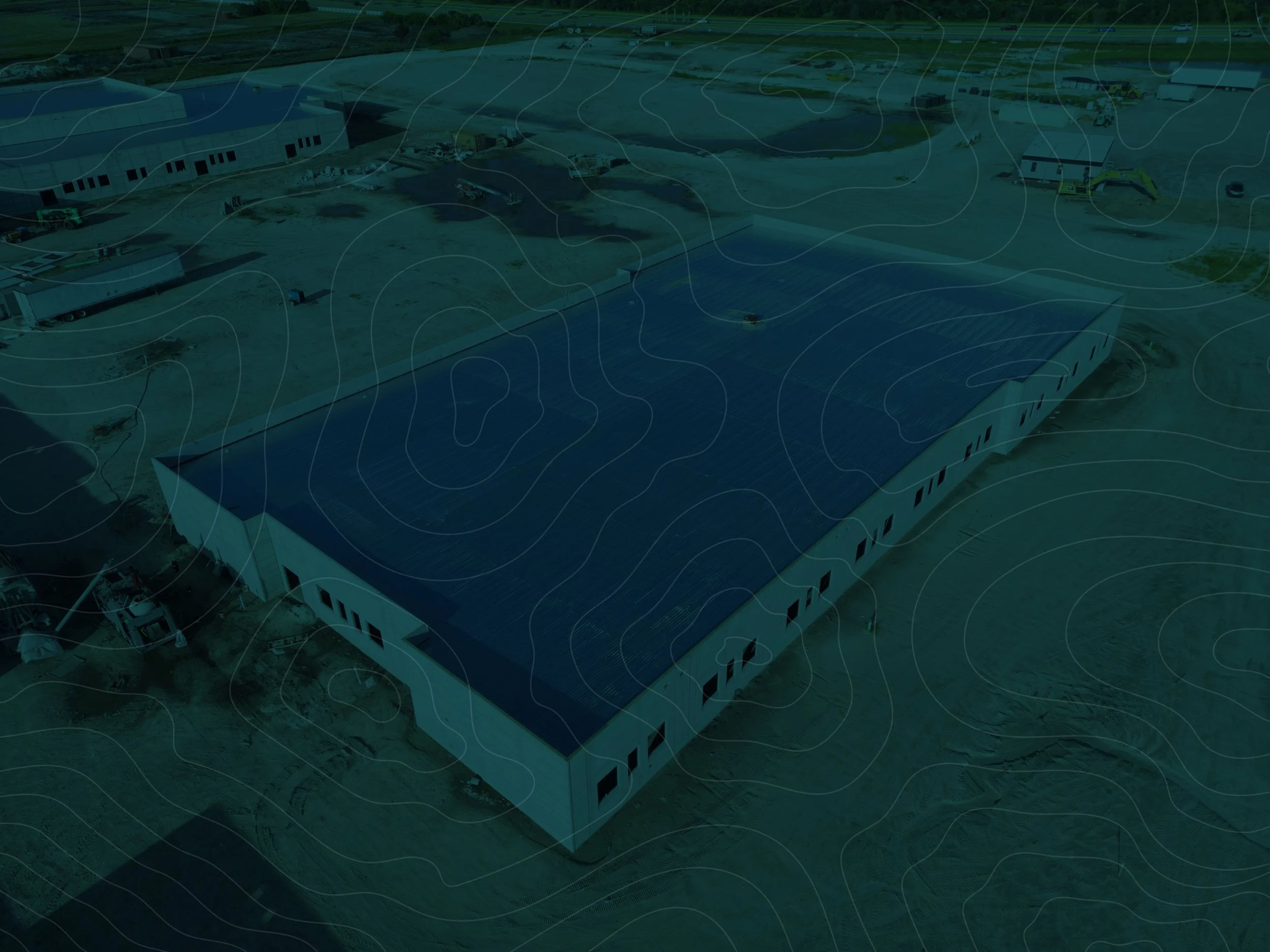
AERIAL PHOTOGRAPHY
Aerial photography captures stunning, high-resolution images from above, showcasing properties and landscapes like never before. Elevate your perspective with eye-catching visuals that make your projects stand out.
-

INSPECTIONS
Drone inspections provide safe, efficient, and detailed visual assessments of hard-to-reach areas, saving time and reducing risk. Get the critical insights you need without the hassle of traditional inspection methods.
-
AND MUCH MORE....
Discover a range of additional services, from 3D modeling to point clouds, designed to elevate your project with cutting-edge drone technology. Visit our services page to explore how we can meet your unique needs and enhance your results.
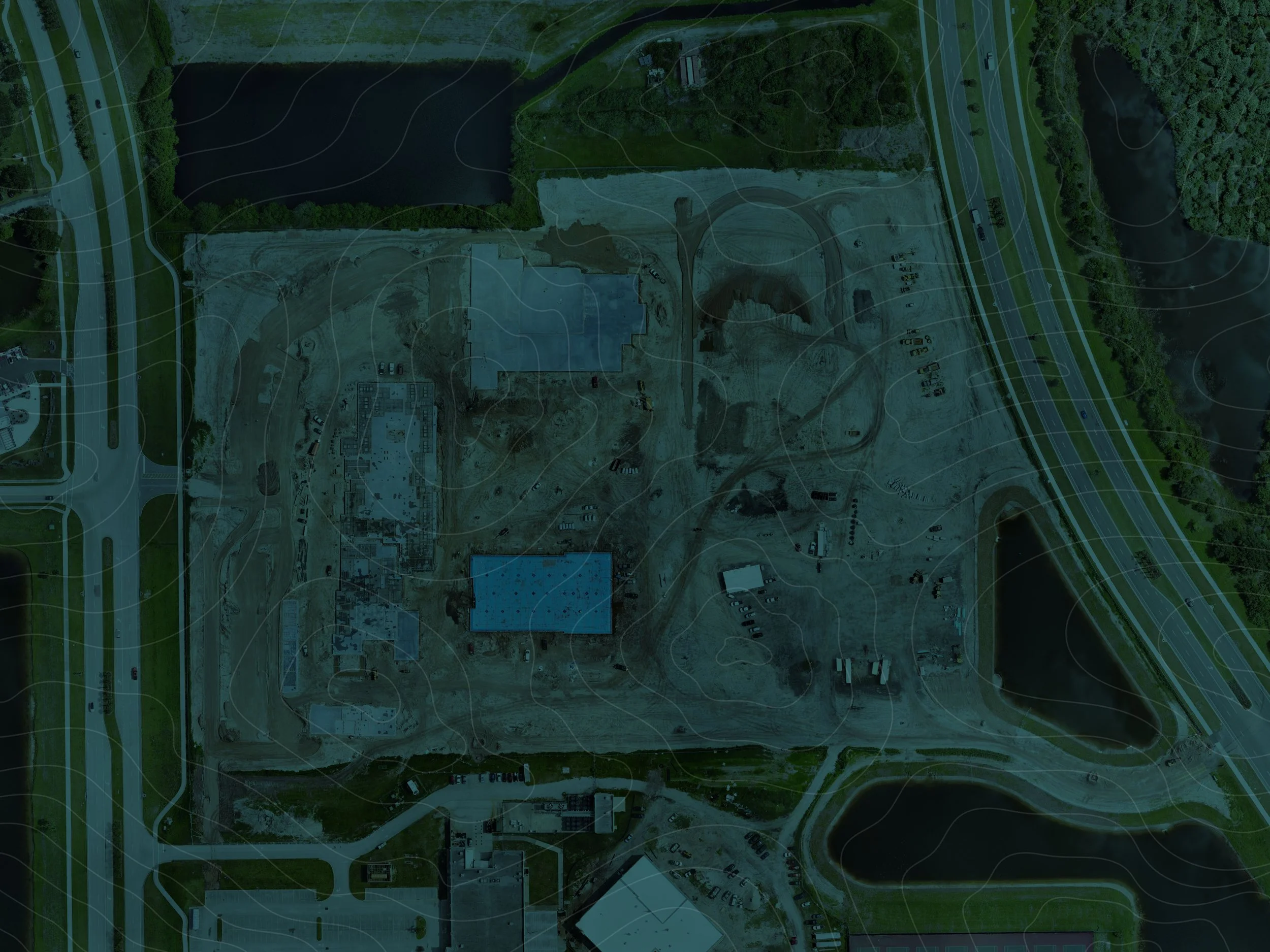
Orthomosaic Mapping
-
Our Orthomosaics service creates highly accurate, georeferenced aerial maps by stitching together drone-captured images, offering a detailed and distortion-free view of your site. These maps are essential for precise planning, monitoring, and analysis across various industries. Learn more...
-
Our Plan Document Overlays service allows you to seamlessly integrate construction plans with high-resolution orthomosaic maps, providing a clear comparison between design intent and actual site conditions. This ensures precise alignment and helps identify discrepancies early in the project. Learn more...
-
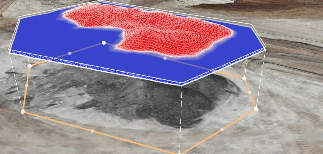
Our Stockpile Analysis & Reports service provides precise volume calculations and detailed reports of your site’s stockpiles using high-resolution orthomosaic data. This ensures accurate inventory management and optimizes resource planning. Learn more...
-
Our Roof Report service delivers comprehensive assessments of roof conditions using high-resolution orthomosaics, providing detailed insights without the need for physical inspections. This enables proactive maintenance and informed decision-making. Learn more...
-
Our Pavement Report service offers detailed assessments of pavement conditions using high-resolution orthomosaics, identifying issues like cracks and wear with precision. This supports effective maintenance planning and long-term pavement management. Learn more...
-
Our Progress Report & Construction Photography service combines high-resolution imagery with orthomosaic mapping to visually track and document your project’s development. This ensures transparent communication and helps keep your project on track. Learn more...
-
Our 3D Models service creates detailed, interactive representations of existing site conditions using high-resolution drone imagery, providing a comprehensive view for planning, design, and analysis. This enhances visualization and supports informed decision-making. Learn more...
-
Our Digital Terrain Model & Point Cloud service generates precise, three-dimensional representations of your site’s terrain, capturing detailed topographical data for accurate planning and analysis. Learn more...
-
Our Elevation Map service provides detailed, color-coded representations of your site’s topography, highlighting elevation changes for precise planning and design. This ensures a clear understanding of the terrain and supports effective project execution. Learn more...